Personal planning page · not indexed

Klettersteige north of the Alps

Every via ferrata in Switzerland you can simply walk up to and climb — no guide, no ticket, no gate — outside Ticino and the south-facing valleys. 62 routes, each with the drive from Bergdietikon and the walk in and walk out spelled out, because the cable car is optional and the legs are not.

Scope. All of Switzerland except Ticino, the Valais valleys south of the Rhône, and the Italian-facing Graubünden valleys (Bergell, Misox, Puschlav, Val Müstair). Guide-only routes, ticketed ferrata parks and commercial canyon courses are excluded. Where a lift exists it is named, and the on-foot alternative is given wherever one is practical.

Lists are saved for nobody yet
Kent Wang · CC BY 4.0
K3–K4BE no lift

Klettersteig Kandersteg–Allmenalp

Kandersteg · Berner Oberland · 1723 m

Drive there
2 h 12
Distance
173 km
On the wire
2 h 30
Climb gain
350 m
Walk in
10 min
Walk out
~1 h 15

Waterfalls, Nepalese bridges, several ladder pitches and a Tyrolienne. The crux is an overhanging traverse below the three-cable bridge.

Approach. 10 min from the Allmenalp cable-car valley station car park

Descent. 20 min on foot to the Allmenalp top station; walking all the way down to Kandersteg takes about 1 h 15

Lift. Allmenalp cable car (Kandersteg ↔ Allmenalp) — used for the descent, not needed for the approach

Season. Mid-May to late October

Very popular — go early. The route finishes at the top station, so you can ride down or walk.

source ↗
No machine-readable author provided. Irmgard assumed (based on copyright claims) · CC BY-SA 3.0
K2BE no lift

Chäligang-Klettersteig

Adelboden / Engstligenalp · Berner Oberland · 1964 m

Drive there
2 h 20
Distance
180 km
On the wire
1 h 30
Climb gain
300 m
Walk in
20 min
Walk out
1 h

Short, generously protected beginner route running right beside the Engstligen falls, with a rest platform overlooking the cascade.

Approach. 20 min from the car park at the Engstligenalp cable-car valley station

Descent. 1 h on foot back down to the car park

Lift. Engstligenalp cable car — optional; the ferrata starts from the valley

Season. Mid-June to mid-October

Ideal first via ferrata. Wide paths, little exposure.

source ↗
Patric Zbinden · Public domain
K4BE no lift

Gantrisch-Klettersteig

Gurnigel / Nünenenberg · Berner Oberland · 2175 m

Drive there
1 h 57
Distance
146 km
On the wire
2 h
Climb gain
220 m
Walk in
45 min
Walk out
1 h 30

Demanding route with overhangs and deliberately offset iron rungs. The lower Küre-Wändli and the airy Horber-Kante near the top are the key sections.

Approach. 45 min from the Nünenenberg car park

Descent. 1 h 30 via the Leiterenpass back to the car park

Lift. None — road access only

Season. Mid-June to end of October

No lift anywhere — entirely a walking day. Rock can be brittle in places.

source ↗
Leo Wehrli · CC BY-SA 4.0
K2BE no lift

Klettersteig Sunnighorn (Simmeflue)

Wimmis · Berner Oberland · 1397 m

Drive there
1 h 46
Distance
150 km
On the wire
2 h
Climb gain
770 m
Walk in
20 min
Walk out
1 h 30

A hiking day with beginner ferrata sections spliced in, climbing steeply above Lake Thun. Aimed squarely at people trying via ferrata for the first time.

Approach. 20 min from the Schnitzelscheune (Brodhüsi) car park in Wimmis

Descent. 1 h 30 via Chrindi

Lift. None

Season. May to end of October

Dry conditions only — the descent gets slippery. Big vertical gain for a K2.

source ↗
Fred · CC BY-SA 3.0
K2BE no lift

Übungsklettersteig Hornflue

Saanenmöser / Gstaad · Berner Oberland · 1870 m

Drive there
2 h 28
Distance
188 km
On the wire
10–15 min
Climb gain
100 m
Walk in
~45 min from Saanenmöser
Walk out
~45 min to Saanenmöser

A tiny practice ferrata — two short lines on the Hornflue with big views over the whole Saanenland.

Approach. Short walk from the Hornberg; reachable by road or by lift from Saanenmöser

Descent. 10–15 min

Lift. Saanenmöser–Hornberg gondola (optional)

Season. June to October

Really a training wall rather than a day out. Good for testing gear or technique.

source ↗
Ximonic (Simo Räsänen) · CC BY-SA 4.0
K3BE lift

Klettersteig Mürren–Gimmelwald

Mürren · Berner Oberland · 1645 m

Drive there
2 h 04
Distance
138 km
On the wire
~2 h 30
Climb gain
340 m down
Walk in
15 min
Walk out
~45 min Gimmelwald → Stechelberg

A descending ferrata traversing the cliffs above Lauterbrunnen with roughly 600 m of air underfoot, finishing on an 80 m Nepalese bridge.

Approach. 15 min from Mürren village

Descent. The route itself descends to Gimmelwald; from there the cable car (or a walk) down to Stechelberg

Lift. Schilthornbahn (Stechelberg–Gimmelwald–Mürren) to reach Mürren; Gimmelwald cable car at the finish

Season. ~June to end of October

Point-to-point and downhill — plan the transport. Earthy, root-covered ledges get slippery when wet.

source ↗
Kurt Ritschard · CC BY-SA 2.0
K2BE lift

Eiger-Rotstock-Klettersteig

Kleine Scheidegg / Eigergletscher · Berner Oberland · 2663 m

Drive there
2 h 04
Distance
139 km
On the wire
~1 h 15
Climb gain
260 m
Walk in
45 min
Walk out
~2 h down to Grindelwald Grund

Alpine route on the Rotstock with the Eiger north face as a backdrop. An 1899 iron ladder and steps chiselled into the limestone give it real historical character.

Approach. 45 min from Eigergletscher station

Descent. 45 min from the Rotstock back to Eigergletscher

Lift. Jungfraubahn / Eiger Express to Eigergletscher

Season. July to October

Loose rock in places; the descent over slabs is adventurous despite the easy grade.

source ↗
Martin Wolff · CC0
K2–K3, crux K3–K4BE lift

Klettersteig Eiger-Ostegghütte

Alpiglen / Grindelwald · Berner Oberland · 2317 m

Drive there
2 h 04
Distance
139 km
On the wire
~3 h total from Alpiglen to the hut
Climb gain
Walk in
45 min
Walk out
~2 h

A hut approach rather than a summit route — a secured line up a gorge with three steep steps, ending at the Ostegghütte on its grass balcony high above Grindelwald.

Approach. 45 min from Alpiglen station along the Eiger Trail to the junction

Descent. Same way back, ~2 h

Lift. Grindelwald–Alpiglen train (or walk up from Grindelwald)

Season. July to September

One smooth slab is the crux and much harder than the rest. Needs sure footing and a genuinely good head for heights.

source ↗
Hermann Hammer · CC BY-SA 4.0
K2–K3BE lift

Schwarzhorn-Klettersteig

Grindelwald First · Berner Oberland · 2928 m

Drive there
2 h 04
Distance
139 km
On the wire
1 h 15 (Grossi Chrinne → summit)
Climb gain
Walk in
2 h
Walk out
~2 h further down to Grindelwald

Long walk-in, then moderately difficult climbing on very airy offset ladders to a 2928 m summit. About 920 m of total height difference over the day.

Approach. 2 h from the First cable-car top station

Descent. 1 h 15 back down to First

Lift. Firstbahn from Grindelwald

Season. July to October

High and committing — needs settled weather. Roughly 5 h round trip from First.

source ↗
Walter Mittelholzer · Public domain
K3 (B/C)BE lift

Tälli-Klettersteig

Gadmen · Berner Oberland · 2500 m

Drive there
1 h 56
Distance
128 km
On the wire
3 h
Climb gain
630 m
Walk in
1 h
Walk out
2 h 30

Switzerland's first modern via ferrata (1993). A 630 m south-facing wall of ladders and traversing bands with genuine alpine flair.

Approach. 1 h from the Tälli cable-car top station (1726 m)

Descent. 2 h 30, including a counter-ascent to the Sätteli

Lift. Tällibahn from Gadmen (1205 m)

Season. July to October

The descent is long and involves re-ascending — a full 6½ h day. Old snow can linger at the entry in early summer.

source ↗
K2 (part 1), K3–K4 (part 2)BE no lift

Tierbergli-Klettersteig

Sustenpass / Steingletscher · Berner Oberland · 2795 m

Drive there
1 h 40
Distance
121 km
On the wire
2 h 30
Climb gain
700 m
Walk in
5 min
Walk out
2 h

High alpine ferrata with glacier views and a lot of real rock contact — slabs first, then steeper ground with scree and snow patches marked by red dots.

Approach. 5 min from the Umpol car park at the end of the road past the Steingletscher

Descent. 2 h on the blue-white alpine trail

Lift. None — road access over the Susten pass

Season. July to end of August

Short season. Snowfields on the upper section; the pass road is closed in winter.

source ↗
Andrew Bossi · CC BY-SA 2.5
K3VS lift

Klettersteig Eggishorn

Fiesch · Wallis (north of the Rhône) · 2869 m

Drive there
2 h 37
Distance
173 km
On the wire
~2 h 30
Climb gain
300 m
Walk in
15 min
Walk out
~3 h down to Fiescheralp/Fiesch

Traverses blocky ground along the Fiescherhorli ridge with a suspension bridge, a three-cable bridge, a timber bridge and an optional zip-line — all above the Great Aletsch Glacier.

Approach. 15 min from the Eggishorn top station

Descent. Back down by cable car from Eggishorn station

Lift. Fiesch–Fiescheralp–Eggishorn cable car

Season. June to October

Mid-route exit available after about an hour. Very exposed to weather at 2800 m.

source ↗
Wandervogel · CC BY-SA 3.0
K3VS no lift

Klettersteig Aletsch (Gibidum)

Blatten bei Naters / Belalp · Wallis (north of the Rhône) · 1436 m

Drive there
3 h 06
Distance
196 km
On the wire
~2 h per bank, ~4 h for the full circuit
Climb gain
Walk in
10 min
Walk out
30 min

About 3 km of ferrata circling the Gibidum reservoir, crossing an impressive suspension bridge and a cable crossing, alternating forest with exposed rock right above the water.

Approach. Short walk from the car park at the Gibidum reservoir dam

Descent. ~30 min back to the dam

Lift. None needed (Belalp cable car nearby)

Season. June to October

The eastern return leg is the harder half, with iron rungs spaced further apart. Low altitude — good early- and late-season option.

source ↗
see below · CC BY-SA 3.0
K3–K4VS lift

Erlebnisklettersteig Gemmiwand

Leukerbad · Wallis (north of the Rhône) · 2346 m

Drive there
3 h 39
Distance
305 km
On the wire
2 h–2 h 30
Climb gain
100 m
Walk in
2–5 min
Walk out
~1 h 30 down the Gemmiweg to Leukerbad

A French-style sports ferrata running roughly horizontally for about 1300 m across the Gemmi wall below the Wildstrubel restaurant. Highlights are a 65 m rope bridge and a ladder that rotates through 540°.

Approach. 2–5 min from the Gemmibahn top station

Descent. Back to the top station; or walk down the historic Gemmi trail to Leukerbad

Lift. Gemmibahn, Leukerbad (1401 m) → Gemmipass (2346 m)

Season. June to October

Almost no height gain but sustained and very exposed — arm strength matters more than fitness.

source ↗
Luan Baruti · CC BY-SA 3.0
K5–K6VS no lift

Leukerbadner Klettersteig (Daubenhorn)

Leukerbad · Wallis (north of the Rhône) · 2941 m

Drive there
3 h 39
Distance
305 km
On the wire
6 h+
Climb gain
1100 m
Walk in
+1 h and 650 m extra if you walk up from Leukerbad
Walk out
~2 h 30 further down the Gemmi trail to Leukerbad

The longest and hardest via ferrata in Switzerland: 1100 m of gain, 216 m of ladders and over 2000 m of steel cable, including a ~100 m natural cave passage.

Approach. ~30 min from the Gemmibahn top station

Descent. From the summit down to the Gemmi pass and back to the station, ~2 h

Lift. Gemmibahn (optional — the route can be done entirely on foot)

Season. July to October

A serious full day. An escape route exists roughly a third of the way up; after that you are committed.

source ↗
Capricorn4049 · CC BY-SA 4.0
K4VS no lift

Baltschieder Klettersteig (Wiwannihütte)

Ausserberg · Wallis (north of the Rhône) · 2470 m

Drive there
3 h 17
Distance
210 km
On the wire
~700 m of route
Climb gain
Walk in
~2 h
Walk out
~1 h 30

The finest and hardest way up to the Wiwannihütte: steep rock, grass ledges and a striking rock tower. Around 5 h for the ascent, 8 h for the whole day.

Approach. ~2 h from Ausserberg station through the Baltschiedertal along the historic Niwärch suone

Descent. ~1 h 30 back down the valley

Lift. None — train to Ausserberg

Season. July to October

Remote and long. The Niwärch suone approach is itself exposed. No lift, no shortcuts.

source ↗
Hyppolyte de Saint-Rambert · CC BY-SA 4.0
K3 / K4 / K6 (three sections)VS no lift

Via Farinetta

Saillon · Wallis (north of the Rhône) · 840 m

Drive there
2 h 57
Distance
253 km
On the wire
2 h 45 for all three sections
Climb gain
400 m
Walk in
30 min
Walk out
1 h

Three stacked sections of increasing severity, with cable bridges at the start, a rope-liana passage and a strenuous overhanging final wall. Exits after each section.

Approach. 30 min from the car park at the Bains de Saillon thermal baths

Descent. 1 h down through the vineyards

Lift. None

Season. Usually April to October

Low, south-facing and hot in summer — best in spring or autumn. Section 3 at K6 is for strong climbers only.

source ↗
Christian David · CC BY-SA 4.0
K4VS no lift

Via ferrata de Tière

Champéry · Wallis (north of the Rhône) · 1226 m

Drive there
2 h 50
Distance
235 km
On the wire
1 h
Climb gain
125 m
Walk in
30 min
Walk out
1 h

Varied sports ferrata with two suspension bridges at a waterfall; vertical steps alternating with exposed traverses. The crux is slightly overhanging.

Approach. 30 min from the main car park in Champéry village centre

Descent. 1 h, via the impressive Galerie Defago

Lift. None needed

Season. May to October

Wet rock near the falls. Low altitude makes it a good shoulder-season option.

source ↗
Christian David · CC BY-SA 4.0
K4VD lift

Via ferrata Tour d'Aï

Leysin · Waadt & Freiburg · 2331 m

Drive there
2 h 51
Distance
233 km
On the wire
1 h 20
Climb gain
150 m
Walk in
45 min
Walk out
~2 h down to Leysin

Airy limestone route to a proper summit with sweeping views over Lake Geneva and across to the Valais Alps.

Approach. 45 min from the Berneuse top station

Descent. 1 h back to the station

Lift. Berneuse gondola from Leysin (1321 m)

Season. May to October (best)

Iron rungs are widely spaced in the couloir section — awkward for shorter climbers.

source ↗
Christian David · CC BY-SA 4.0
K5VD lift

Via ferrata de la Tête aux Chamois

Les Diablerets / Col du Pillon · Waadt & Freiburg · 2525 m

Drive there
2 h 57
Distance
241 km
On the wire
~1 h 30 (about 800 m of route)
Climb gain
Walk in
You climb down to the start
Walk out
long — the lift is effectively required

French-style sports ferrata across the north side of the Tête aux Chamois: a chain of natural ledges that narrow to a single foot-width, plus the notorious Rocher Jaune traverse.

Approach. You climb down to the start from the lift; ~15 min

Descent. Climb back up to the cable car at the finish, ~30 min

Lift. Glacier 3000 cable car from Col du Pillon

Season. July to October

Technically moderate but ferociously exposed, with strength-sapping overhangs. Escape onto the scree a third of the way along.

source ↗
Alexander Klyuch · Public domain
K4VD no lift

Via ferrata de la Cascade du Dar

Les Diablerets · Waadt & Freiburg · 1520 m

Drive there
2 h 57
Distance
241 km
On the wire
1 h 30
Climb gain
50 m
Walk in
15 min
Walk out
20 min

French-style sports route: an overhanging traverse out to the waterfall, a demanding cable bridge at the very start and a narrow squeeze near the cascade.

Approach. 15 min from the Glacier 3000 valley station car park at Col du Pillon

Descent. 20 min

Lift. None needed

Season. June to October

Slippery in the spray zone. Very little height gain but sustained on the arms.

source ↗
Zacharie Grossen · CC BY-SA 4.0
K2 (with K4 passages)VD no lift

Via ferrata de Pierredar (Dames Anglaises)

Les Diablerets · Waadt & Freiburg · 2792 m

Drive there
2 h 52
Distance
237 km
On the wire
1–2 h
Climb gain
210 m
Walk in
~4 h from Les Diablerets
Walk out
~3 h to Les Diablerets

430 m of route high above the Pierredar refuge, replacing the older Pierredar line that was destroyed by rockfall.

Approach. 45 min–1 h from the Refuge de Pierredar; about 4 h on foot from Les Diablerets

Descent. Back to the refuge, ~45 min

Lift. None — this is a walk-in

Season. July to September

Long, remote approach — realistically an overnight at the refuge. Officially K2 but with distinctly harder passages.

source ↗
Deali00 · CC BY-SA 4.0
K5VD no lift

Via ferrata de Plan Praz

Leysin (Feydey) · Waadt & Freiburg · 1550 m

Drive there
2 h 51
Distance
233 km
On the wire
1 h 30
Climb gain
30 m
Walk in
20 min
Walk out
30 min

Almost no height gain and entirely about difficulty: powerful overhangs, several suspension bridges, beams and ladders on a compact wall right above the village.

Approach. 20 min from Feydey in Leysin (1398 m)

Descent. 30 min

Lift. None needed

Season. May to October

For strong, experienced climbers only. Two exit options.

source ↗
Jean Housen · CC BY 3.0
K3–K4VD no lift

Via ferrata du Lavanchy

Pont-de-Nant (Bex / Les Plans) · Waadt & Freiburg · 1550 m

Drive there
2 h 52
Distance
235 km
On the wire
30 min
Climb gain
50 m
Walk in
1 h
Walk out
~1 h

A very short, well-protected sports ferrata in a beautiful setting at the head of the Vallon de Nant, with mild overhangs and traverses.

Approach. 1 h from the Pont-de-Nant car park

Descent. ~1 h

Lift. None

Season. June to October

Short — worth combining with the walk up to the Pont-de-Nant botanical garden. Not a beginner route despite its brevity.

source ↗
Ian Furst · CC BY-SA 4.0
Route 1 easy · Route 2 moderate · Route 3 very difficultVD lift

Via ferrata de la Videmanette (3 routes)

Rougemont · Waadt & Freiburg · 2284 m

Drive there
2 h 37
Distance
206 km
On the wire
1–2 h depending on route
Climb gain
Walk in
5 min
Walk out
~2 h down to Rougemont

Three parallel routes of increasing difficulty (500 m / 380 m / 400 m) up to the summit of the Rubli, with a 360° panorama at the top.

Approach. 5 min from the La Videmanette top station

Descent. Back to the top station, ~20 min

Lift. Rougemont–La Videmanette cable car

Season. Mid-June to October

The three grades make it an unusually good place to bring a mixed-ability group.

source ↗
Christian David · CC BY-SA 4.0
K5VD lift

Via ferrata des Rochers de Naye

Montreux / Jaman · Waadt & Freiburg · 2042 m

Drive there
2 h 23
Distance
201 km
On the wire
1 h 30–2 h
Climb gain
Walk in
~20 min
Walk out
long — the railway is the sensible option

Steep, famously exposed limestone with the drop running straight down to Lake Geneva.

Approach. ~20 min from Jaman station

Descent. ~45 min back, or take the train down from Rochers-de-Naye

Lift. Montreux–Rochers-de-Naye cog railway (alight at Jaman)

Season. June to October

Has an escape route. Serious grade — not a first ferrata.

source ↗
Christian David · CC BY-SA 4.0
K4–K5FR lift

Via ferrata Le Moléson (Le Pilier – La Face)

Moléson-sur-Gruyères · Waadt & Freiburg · 2002 m

Drive there
2 h 13
Distance
180 km
On the wire
2 h 30
Climb gain
372 m
Walk in
~1 h 30 from Moléson-Village
Walk out
2 h 30

Well-equipped sports route with abundant iron rungs and little direct rock contact. Two variants (left is easier), finishing on an exposed overhanging traverse.

Approach. 10 min from the Plan-Francey middle station

Descent. 2 h 30 on foot back to the car park, or ride the cable car down from the summit

Lift. Moléson funicular to Plan-Francey, then cable car from the summit

Season. June to October

North-facing, so cold in the morning. There is a voluntary maintenance donation box — access itself is free.

source ↗
Alps · Public domain
K3 / K5 / K6 (three lines)FR lift

Via ferrata de Charmey

Charmey · Waadt & Freiburg · 1814 m

Drive there
2 h 57
Distance
194 km
On the wire
2 h 45
Climb gain
160 m
Walk in
30 min
Walk out
~1 h 30 to Charmey

Cable nets, wire bridges, a cave and a Tibetan bridge, with three lines side by side. Summit views to the Gastlosen and the Moléson.

Approach. 30 min from the Charmey cable-car top station

Descent. 40 min

Lift. Charmey (Vounetz) cable car

Season. May to October

No intermediate exits — once you start you finish. Pick your line before committing.

source ↗
W. Bulach · CC BY-SA 4.0
K4–K5OW lift

Klettersteig Fürenwand

Engelberg · Zentralschweiz · 1850 m

Drive there
1 h 17
Distance
89 km
On the wire
2 h 45
Climb gain
550 m
Walk in
20 min
Walk out
~1 h 30

One of the undisputed Swiss classics: a sheer wall opposite the Titlis, with a steep exposed first section and a very airy 20 m rope ladder near the top.

Approach. 20 min from the Fürenalp cable-car valley station car park

Descent. By cable car from Fürenalp; walking down takes about 1 h 30

Lift. Fürenalp cable car — used for the descent

Season. May to end of October

Not for beginners. The rope ladder needs arm strength and nerve — there is no way round it.

source ↗
Kent Wang · CC BY 4.0
K2OW lift

Klettersteig Brunnistöckli

Engelberg (Brunni) · Zentralschweiz · 2030 m

Drive there
1 h 17
Distance
89 km
On the wire
1 h from the cable-car station to the top
Climb gain
Walk in
~1 h 30 up from Engelberg
Walk out
~1 h 30 to Engelberg

The classic Swiss beginner ferrata — short approach, about 200 m of gain and two suspension bridges. Popular with families.

Approach. From the Brunni cable-car top station

Descent. 20 min back to the Brunnihütte

Lift. Brunni cable car (Engelberg–Ristis)

Season. June to October

Not recommended for children under 8. Gear rental at the lift (CHF 25).

source ↗
W. Bulach · CC BY-SA 4.0
K4OW lift

Klettersteig Zittergrat

Engelberg (Brunni) · Zentralschweiz · 1927 m

Drive there
1 h 17
Distance
89 km
On the wire
40 min from the cable-car station
Climb gain
Walk in
~1 h 30 up from Engelberg
Walk out
~1 h 30 to Engelberg

Right next to the Brunnistöckli and finishing at the same point, but short, steep and genuinely exposed — the hardest of the Brunni routes.

Approach. From the Brunni cable-car top station

Descent. 20 min

Lift. Brunni cable car

Season. June to October

Needs arm strength and a good head. Often combined with the Brunnistöckli in one outing.

source ↗
Paradise Chronicle · CC BY-SA 4.0
K3OW lift

Klettersteig Rigidalstockgrat

Engelberg (Brunni) · Zentralschweiz · 2577 m

Drive there
1 h 17
Distance
89 km
On the wire
3 h 30 from the cable-car station
Climb gain
Walk in
add ~1 h 30 from Engelberg
Walk out
~1 h 30 further to Engelberg

The easier of the two Rigidalstock lines and suitable for beginners, but with a serious alpine walk-in and a proper 2577 m summit.

Approach. Long walk-in from the Brunni top station via the Brunni-Pfad

Descent. 1 h 30 from Schonegg back to the Brunnihütte

Lift. Brunni cable car

Season. July to October

A full day. Often linked with the Brunnistöckli lower down.

source ↗
Werner Friedli · CC BY-SA 4.0
K3–K4OW lift

Klettersteig Rigidalstockwand

Engelberg (Brunni) · Zentralschweiz · 2577 m

Drive there
1 h 17
Distance
89 km
On the wire
3 h 30 from the cable-car station
Climb gain
Walk in
add ~1 h 30 from Engelberg
Walk out
~1 h 30 further to Engelberg

The wall variant on the Rigidalstock — steeper and harder than the ridge line, and explicitly not a beginner route.

Approach. Same walk-in as the Grat route, from the Brunni top station

Descent. 1 h 30 back to the Brunnihütte

Lift. Brunni cable car

Season. July to October

Long day with a demanding finish. Check conditions at the Brunni lift.

source ↗
Roy Egloff · CC BY-SA 4.0
K3 (part 1), K4–K5 (part 2)OW no lift

Graustock-Klettersteig

Engstlenalp / Jochpass · Zentralschweiz · 2662 m

Drive there
2 h 10
Distance
119 km
On the wire
2 h 30
Climb gain
460 m
Walk in
1 h 30
Walk out
~2 h

Mixed mountain path over slabs linked by steep, exposed ferrata pitches. The crux is short and fierce, and you have to find your own holds.

Approach. 1 h 10 from Engstlenalp to the Jochpass, plus 20 min; or start at the Jochpass lift station

Descent. ~2 h back down to Engstlenalp

Lift. Jochpass chairlift from Trübsee/Engstlenalp (optional)

Season. Late June to early October

The second part jumps to K4–K5 — check you are happy before committing past part 1.

source ↗
W. Bulach · CC BY-SA 4.0
K3OW lift

Fruttlisteig (Bonistock)

Melchsee-Frutt · Zentralschweiz · 2160 m

Drive there
1 h 19
Distance
87 km
On the wire
20 min
Climb gain
60 m
Walk in
30 min
Walk out
~1 h 30 down to Stöckalp

A tiny route through a rock band up towards the Bonistock. Its signature is an old chairlift seat bolted to the wall as a viewing perch over the Melchsee.

Approach. 30 min from Melchsee-Frutt

Descent. 30 min

Lift. Stöckalp–Melchsee-Frutt gondola (hourly)

Season. June to October

Very short — best treated as an add-on to a hiking day at Melchsee-Frutt.

source ↗
Werner Friedli · CC BY-SA 4.0
K4UR lift

Klettersteig Fruttstägä

Bürglen (Biel-Kinzig) · Zentralschweiz · 2040 m

Drive there
1 h 11
Distance
81 km
On the wire
45 min
Climb gain
100 m
Walk in
1 h
Walk out
~2 h

Short, well-protected route with an exposed sitting bench bolted to a near-vertical wall and a 10 m rope bridge near the finish.

Approach. 1 h from the Biel-Kinzig cable-car top station

Descent. ~2 h back to the cable-car station

Lift. Biel-Kinzig cable car from Brügg near Bürglen

Season. Summer (check lift operating times)

The crux is right above the entry and slightly overhanging — there is an easier alternative line.

source ↗
Badener · CC BY 3.0
K2NW lift

Klettersteig Klewenalp–Ergglen

Beckenried · Zentralschweiz · 1700 m

Drive there
1 h 02
Distance
77 km
On the wire
~20 min
Climb gain
40 m
Walk in
30 min
Walk out
~2 h down to Beckenried

A short family route with three wire bridges and a cave-like passage, very well secured with plenty of iron steps, looking out over Lake Lucerne.

Approach. 30 min from the Klewenalp top station to the Ergglen barbecue site

Descent. 30 min back to the top station

Lift. Beckenried–Klewenalp cable car

Season. Klewenalp–Stockhütte summer season

Genuinely tiny — a fun stop rather than a day, ideal for first-timers and children.

source ↗
Simon Koopmann · CC BY-SA 2.5
K2–K4UR lift

Klettersteig Adlerhorst

Intschi / Arnisee · Zentralschweiz · 1700 m

Drive there
1 h 18
Distance
95 km
On the wire
~1 h
Climb gain
140 m
Walk in
20 min
Walk out
~1 h 30 down to Intschi

Beginner-friendly, solidly protected route in lovely spruce forest surroundings: a short entry ladder, a leftward traverse and a small overhang as the crux.

Approach. 20 min from the Berggasthaus Alpenblick at Arnisee

Descent. 45 min back to the cable-car station

Lift. Intschi–Arnisee cable car

Season. Early May to end of November

Has an intermediate exit. Long season thanks to the modest altitude.

source ↗
FFA P-16 · CC BY-SA 4.0
K2–K3UR no lift

Via ferrata del Diavolo

Andermatt / Schöllenen · Zentralschweiz · 1875 m

Drive there
1 h 33
Distance
112 km
On the wire
~2 h
Climb gain
500 m
Walk in
15 min
Walk out
1 h

Exceptionally well-secured granite route above the Schöllenen gorge, with views down onto the Devil's Bridge and the road's hairpins.

Approach. 15 min from the car park after the roundabout at the entrance to Andermatt

Descent. 1 h on foot

Lift. None

Season. Closed 1 December – 30 April (wildlife protection)

The difficulty is the sheer length rather than any single move; a small overhang near the end is the crux. Gets busy.

source ↗
Capricorn4049 · CC BY-SA 4.0
K5UR lift

Hexensteig am Pfaffen

Silenen · Zentralschweiz · 1835 m

Drive there
1 h 17
Distance
90 km
On the wire
1 h 15
Climb gain
130 m
Walk in
1 h
Walk out
long — the little cable car is the practical option

Runs largely through the inside of the mountain, over tree trunks and iron steps, and opens with a Tyrolean traverse across a small gorge.

Approach. 1 h from the Chilcherberge cable-car top station

Descent. 45 min

Lift. Open-air Chilcherberge cable car (very limited parking at the valley station)

Season. Summer (check cable-car hours)

Steep, partly overhanging and dangerous when wet. The tiny open-air cable car has very limited capacity and parking.

source ↗
Bergdohle · CC BY-SA 3.0
K3UR no lift

Klettersteig Krokodil (Bergsee)

Göscheneralp · Zentralschweiz · 2527 m

Drive there
1 h 39
Distance
116 km
On the wire
1 h 30
Climb gain
130 m
Walk in
~1 h 20
Walk out
~1 h 20

400 m of steel cable over two rock towers, the second of which really does look like a crocodile's head. Lots of direct rock contact and a wire bridge near the finish.

Approach. 1 h from the Berggasthaus Dammagletscher car park to the Bergseehütte, then 20 min

Descent. 20 min to the hut, then ~1 h back to the car park

Lift. None — road to Göscheneralp

Season. While the Bergseehütte is staffed — contact the hut

Views over the Bergsee, Göscheneralpsee and Dammagletscher. Best combined with a night at the Bergseehütte.

source ↗
Bertrand Semelet · CC BY-SA 3.0
K3 (C)UR no lift

Klettersteig Schijen Zwärg

Göscheneralp · Zentralschweiz · 2330 m

Drive there
1 h 39
Distance
116 km
On the wire
~30 min (about 120 m of route)
Climb gain
80 m
Walk in
~1 h 20
Walk out
~1 h 20

A short, scenic ferrata spliced into the walk up to the Bergseehütte — a neat warm-up for the Krokodil route above.

Approach. On the T3 path from the Göscheneralpsee up to the Bergseehütte

Descent. Continue to the Bergseehütte, then ~1 h back down

Lift. None

Season. Summer, while the hut is staffed

Very short; only worth it as part of the Bergseehütte day.

source ↗
Uwelino · CC BY-SA 4.0
K3–K4 (C/D)UR no lift

Salbit-Höhenweg / Salbit-Kettenweg

Göschenen · Zentralschweiz · 2480 m

Drive there
1 h 27
Distance
106 km
On the wire
~1 h 30 for the secured wall
Climb gain
350 m
Walk in
~2 h 20
Walk out
~2 h 30

Not a pure ferrata: a long alpine day mixing hiking, scree and boulders with a 50 m secured wall, plus the spectacular 90 m Salbit suspension bridge on the Höhenweg to the Voralphütte.

Approach. From the Ulmi car park (1195 m) or the Voralpkehre (1404 m); ~2 h 20 up to the Salbithütte

Descent. ~2 h 30

Lift. None

Season. Summer, settled weather

About 1285 m of total gain and 7 h 30. The Salbithütte at 2105 m breaks it up.

source ↗
Earth Science and Remote Sensing Unit, Lyndon B. Johnson Space Center · Public domain
K2 (Felspfad) / K3 (Klettersteig)SZ no lift

Klettersteig Husky-Lodge & Felspfad

Muotathal · Zentralschweiz · 720 m

Drive there
1 h 05
Distance
76 km
On the wire
1 h
Climb gain
100 m
Walk in
10 min
Walk out
~20 min

Two well-protected lines side by side. The Felspfad is about as gentle an introduction to via ferrata as exists; the main route goes vertically up the wall, then a ladder, a ledge traverse and a final push.

Approach. 10 min from the car park at the Erlebniswelt Muotathal

Descent. ~20 min

Lift. None

Season. All year — low and south-facing

Genuinely usable in winter, which is rare. Perfect for a first try or an off-season fix.

source ↗
Andrew Bossi · CC BY-SA 2.5
K2 / T5−SZ no lift secured path, not a ferrata

Rigi-Kulm-Nordwestrippe (Bänderweg)

Seebodenalp / Küssnacht am Rigi · Zentralschweiz · 1798 m

Drive there
45 min
Distance
51 km
On the wire
~2 h
Climb gain
320 m
Walk in
30 min
Walk out
1 h 15

The Bänderweg up the Rigi's north-west rib — three short rock steps and flower-covered ledges to the summit, well away from the cog-railway crowds. The key pitch is a steep 40 m nagelfluh band rigged with a 'pearl chain': steel cable threaded with plastic balls every 10 cm.

Approach. 30 min from Seebodenalp (1020 m), reached by a narrow road up from Küssnacht am Rigi; parking CHF 8 / 24 h

Descent. 1 h 15 back down to Seebodenalp, or continue to Rigi Kulm and take the cog railway

Lift. None needed — road to Seebodenalp (a cable car from Küssnacht also serves it)

Season. May to October

Not really a via ferrata. There is no continuous cable to clip into and a set is not needed — the pearl chain actively makes clipping awkward. Graded T5− as an alpine walk. Practically unwaymarked, and the steep grass is dangerous when wet.

source ↗
Lutz Fischer-Lamprecht · CC BY-SA 4.0
K4–K5 (D)UR no lift

Klettersteig Zingelstöckli

Urnerboden · Ostschweiz · 1720 m

Drive there
1 h 41
Distance
114 km
On the wire
~2 h (about 300 m of route)
Climb gain
Walk in
30 min
Walk out
~1 h

Opened in 2016 on Switzerland's largest alp. A sporty line with steep and overhanging passages.

Approach. 30 min on the path behind the former Gasthaus Tell in Urnerboden

Descent. ~1 h back to the village

Lift. None — Klausen pass road

Season. Summer — the Klausen pass is closed in winter

Strongly advised against in the wet. Not for beginners. Free parking by the church; gear can be hired in the village shop.

source ↗
Felix Günther FeG · CC BY-SA 2.5
K3 to K5GL lift

Braunwalder Klettersteig (Eggstöcke)

Braunwald · Ostschweiz · 2449 m

Drive there
1 h 28
Distance
100 km
On the wire
2 h 45
Climb gain
670 m
Walk in
~50 min
Walk out
~2 h 30 to Braunwald

A ridge traverse over four summits of the Eggstöcke with escalating difficulty. The K5 section to the rear summit is overhanging with widely spaced holds; two intermediate exits allow a shorter day.

Approach. ~50 min from the Berggasthaus Gumen (1904 m)

Descent. 1 h 30

Lift. Linthal–Braunwald funicular (Braunwald is car-free), then the Gumen chairlift

Season. June to October

Beginner and children's variants exist near the mountain restaurant. Braunwald is car-free — factor the funicular into your timing.

source ↗
Caumasee · Public domain
K3–K4GL no lift

Indianer-Klettersteig Netstal

Netstal · Ostschweiz · 700 m

Drive there
1 h 03
Distance
81 km
On the wire
1 h
Climb gain
70 m
Walk in
30 min
Walk out
~45 min

Short but varied: a cave, a ladder and a Tyrolean traverse with a fixed pulley, finishing on an overhanging push to the top.

Approach. 30 min from the car park near the Schlattstein erratic beside the Linth in Netstal

Descent. ~45 min

Lift. None

Season. Early season — usable when higher routes are still snowed in

Exposed and technically demanding despite the low altitude. There is an emergency exit partway.

source ↗
Drdamage · CC BY-SA 4.0
K2 (B/C)SG no lift secured path, not a ferrata

Speer-Kletterweg

Amden / Kaltbrunn · Ostschweiz · 1951 m

Drive there
1 h 02
Distance
81 km
On the wire
~4–5 h to the summit in total
Climb gain
Walk in
1 h 30
Walk out
2 h 30

A secured climbing path up Europe's highest grass-covered peak, above the Walensee.

Approach. 1 h 30 from the free Mittelwengi car park (1150 m) via the Obere Rossalpe

Descent. 2 h 30; adding the Bützli descent variant costs about another 2 h 30

Lift. None

Season. June to October

Closer to an exposed alpine route with cables than a modern sports ferrata. Long day.

source ↗
JoachimKohler-HB · CC BY-SA 4.0
K1–K2 (secured path)AI/SG lift secured path, not a ferrata

Lisengrat & Nasenlöcherweg

Säntis / Rotsteinpass · Ostschweiz · 2502 m

Drive there
1 h 32
Distance
105 km
On the wire
~2 h Rotsteinpass → Säntis
Climb gain
Walk in
~3 h from Wasserauen to the Rotsteinpass
Walk out
~2 h 30 to Schwägalp

The famous exposed ridge from the Rotsteinpass to the Säntis, cable-protected throughout, plus the Nasenlöcherweg in the Alpstein.

Approach. Via Schwägalp or Wasserauen; the Lisengrat links the Rotsteinpass to the Säntis summit

Descent. Säntis cable car, or walk down to Schwägalp

Lift. Säntis-Schwebebahn from Schwägalp; Ebenalp cable car from Wasserauen

Season. July to October

A secured alpine path rather than a true via ferrata — most walkers do it without a ferrata set, but it is seriously exposed and dangerous in snow or ice.

source ↗
Anonym/e Künstler/in · Public domain
K1–K2 (A/B)GR no lift

Fläscher Leiterliweg

Fläsch · Graubünden · 900 m

Drive there
1 h 23
Distance
113 km
On the wire
10–15 min
Climb gain
Walk in
~40 min
Walk out
~40 min

A mini ferrata of ladders on the cliffs above Fläsch, with only 10–15 minutes of actual climbing.

Approach. Short walk from Fläsch above the Bündner Herrschaft vineyards

Descent. ~40 min

Lift. None

Season. Almost all year — very low and sunny

Trivially short. Worth it as a warm-up combined with a walk in the Bündner Herrschaft.

source ↗
upload by Adrian Michael · CC BY-SA 3.0
K1–K2GR no lift

Klettersteig Pinut

Flims / Fidaz · Graubünden · 2050 m

Drive there
1 h 54
Distance
152 km
On the wire
~2 h 30
Climb gain
700 m
Walk in
30 min from Fidaz
Walk out
~2 h 35

First documented in 1739 and fully renovated in 2007 — the oldest via ferrata in Switzerland. Ladders and stairs through three rock faces and caves in the Flimserstein, separated by the Pinut and Pardatsch meadows.

Approach. 30 min up through the forest from Fidaz (200 m of gain); about 1 h 15 from Flims village

Descent. 1 h 15 down to Bargis, then about 2 h back to Fidaz/Flims

Lift. None

Season. May to October

Around 5 h for the whole tour. Easy technically but a long day; free access with a donation box.

source ↗
böhringer friedrich · CC BY-SA 2.5
K4–K5 (C/D)GR no lift

Sulzfluh-Klettersteig

St. Antönien / Partnun · Graubünden · 2817 m

Drive there
2 h 04
Distance
148 km
On the wire
2 h 30
Climb gain
420 m
Walk in
1 h 30
Walk out
2 h 30

The classic of the three Partnun routes: an exemplary south-facing line up brilliant white limestone with abundant rungs, short ladders, a cable bridge and a ladder bridge. 500–600 m of steel cable, and a famous rest ledge — the Bankli — halfway.

Approach. 1 h 30 from the car parks at the head of the Partnun valley (1700 m), on the marked path towards the Carschinahütte

Descent. 2 h 30

Lift. None

Season. June to October

1150 m of total gain and 6 h 30 for the day. The cable is removed for the winter.

source ↗
Vince51 · CC BY 3.0
K4–K5 (D/E)GR no lift

Partnunblick-Klettersteig

St. Antönien / Partnun · Graubünden · 2300 m

Drive there
2 h 04
Distance
148 km
On the wire
2 h 45
Climb gain
320 m
Walk in
2 h
Walk out
2 h 30

Climbs the Gemstobelwand with steadily rising difficulty, usually entered via the family route below. The short final wall is D/E and extremely exposed.

Approach. 2 h from car park no. 6 at Partnun (1631 m)

Descent. 2 h 30

Lift. None

Season. May to October

No emergency exit anywhere, and the crux waits until the very end. Experienced parties only.

source ↗
FkMohr · CC BY-SA 3.0 de
K2 (A/B–B)GR no lift

Familien-Klettersteig Partnunblick

St. Antönien / Partnun · Graubünden · 2100 m

Drive there
2 h 04
Distance
148 km
On the wire
1 h 30
Climb gain
150 m
Walk in
1 h 30
Walk out
1 h 45

About 180 m zig-zagging up the wall with two short cable bridges and two platform pillars to exit from, high above the turquoise Partnunsee.

Approach. 1 h 30 from car park no. 6 at Partnun (1631 m)

Descent. 1 h 45

Lift. None

Season. July to September

Recommended from age 8. 4 h 45 for the round trip — the walking, not the climbing, is the effort.

source ↗
böhringer friedrich · CC BY-SA 2.5
K3 (C)GR no lift

Gauablickhöhle-Klettersteig

St. Antönien / Partnun · Graubünden · 2600 m

Drive there
2 h 04
Distance
148 km
On the wire
~1 h 30 (260 m of route)
Climb gain
Walk in
~3 h
Walk out
~2 h 45

A moderate route on the north flank of the Sulzfluh whose highlight is entering the Gauablickhöhle — a 350 m cave — right in the middle of the climb.

Approach. ~3 h, on the north side of the Sulzfluh

Descent. ~2 h 45

Lift. None

Season. July to September

Long approach and descent make this a big day. Take a head torch for the cave.

source ↗
Andreas Fischler · CC BY 2.0
K3 (B)GR no lift

Klettersteig Punteglias

Trun (Surselva) · Graubünden · 2400 m

Drive there
2 h 18
Distance
179 km
On the wire
Climb gain
Walk in
~3 h
Walk out
~2 h 30

A remote granite route in the Val Punteglias above Trun, usually combined with a visit to the Camona da Punteglias. Outdooractive gives the full circuit as roughly 12.6 km and 9 h.

Approach. Long walk-in up the Val Punteglias towards the Camona da Punteglias

Descent. Back down the valley

Lift. None

Season. July to September

Data thin — verify with the hut before going. Very much a wilderness day.

Sparse data — verify locally before you commit to this one.

source ↗
Basotxerri · CC BY-SA 4.0
K3, with a K5 variantGR lift

Greitspitz-Klettersteig

Samnaun · Graubünden · 2872 m

Drive there
3 h 27
Distance
243 km
On the wire
1 h 30
Climb gain
150 m
Walk in
30 min
Walk out
~2 h down to Samnaun

Built in 2001. A sports ferrata with two variants, one of them extremely exposed and graded K5, on the Silvretta border ridge.

Approach. 30 min from the Flimsattel lift station

Descent. 30 min back to the lift

Lift. Samnaun cable cars to Alp Trida / Flimsattel

Season. July to October

Combines well with the easier Flimspitz route on the same lift ticket.

source ↗
Capricorn4049 · CC BY-SA 4.0
K3GR lift

Flimspitz-Klettersteig

Samnaun · Graubünden · 2929 m

Drive there
3 h 27
Distance
243 km
On the wire
~1 h 30
Climb gain
Walk in
From the Alp Trida / Flimsattel lift stations
Walk out
~2 h to Samnaun

Opened in 2004, with enjoyable slab climbing. The easier companion to the Greitspitz route next door.

Approach. From the Alp Trida / Flimsattel lift stations

Descent. ~45 min back to the lift

Lift. Samnaun cable cars

Season. July to October

The Samnaun lifts have limited summer operating dates — check before travelling.

source ↗
K3, K4 at the 'Adlerhorst'GR no lift

Klettersteig La Resgia

Pontresina · Graubünden · 2198 m

Drive there
2 h 58
Distance
221 km
On the wire
1 h 30
Climb gain
370 m
Walk in
15 min
Walk out
30 min

Varied climbing with a wire bridge, mesh netting and ladders, and a choice of two difficulty levels partway. The slightly overhanging Adlerhorst crux makes you climb round an arête. Combine it with the Klettersteig Languard, which is more peaceful and leads to a very scenic top.

Approach. 15 min from the car park by the Seiler AG works yard, opposite Hotel Palü

Descent. 30 min

Lift. None — starts from the village

Season. June to October

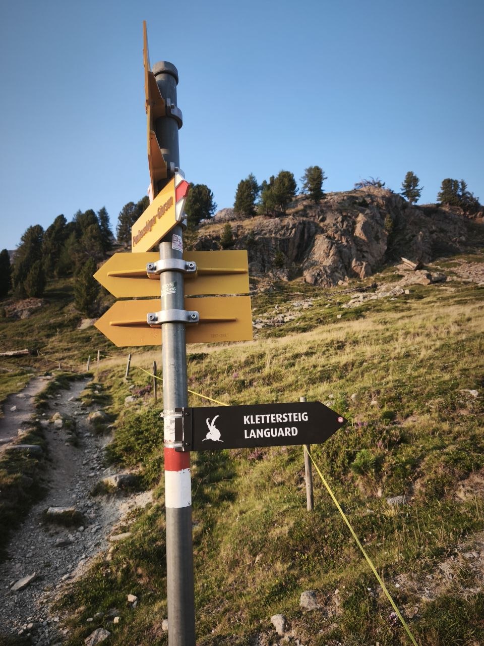
Starts straight from Pontresina, so no lift and no logistics — one of the most convenient routes in the Engadin. After the La Resgia exit, follow the signposted path towards Alp Languard for the second ferrata.

source ↗
NOTE: This image is a panorama of Diavolezza consisting of 11 frames that were m · CC BY-SA 3.0
K2–K3; variant II up to K6GR lift

Klettersteig Piz Trovat (I & II)

Diavolezza / Pontresina · Graubünden · 3146 m

Drive there
3 h 05
Distance
229 km
On the wire
1 h 20
Climb gain
300 m
Walk in
30 min
Walk out
~1 h 30 down to the Bernina pass road

Steep entry ladder, then slabs, a rope bridge and an overhanging crux, with stupendous views over the Morteratsch and Pers glaciers. Piz Trovat II branches off and is savagely strenuous.

Approach. 30 min from the Diavolezza top station

Descent. 30 min back to the top station

Lift. Diavolezza cable car from the Bernina line station (15 min ride)

Season. July to October

At 3146 m this is high — weather changes fast. The descent crosses scree and snow patches. Variant II needs Tyrolienne braking gear and real expertise.

source ↗
Thinkingoyster · CC BY-SA 4.0
K3NE no lift

Via ferrata du Tichodrome

Noiraigue (Val-de-Travers) · Jura · 1119 m

Drive there
2 h 11
Distance
162 km
On the wire
1 h
Climb gain
150 m
Walk in
30 min
Walk out
30 min

Mostly a traverse across Jura limestone, well secured and generously equipped with holds, looking across the valley to the Creux du Van.

Approach. 30 min from Noiraigue station, or 5 min from the Restaurant du Haut de la Côte car park

Descent. 30 min back to the station (or 5 min to the restaurant)

Lift. None — train to Noiraigue

Season. 15 July to 31 December (closed in spring for nesting birds)

In the Jura rather than the Alps, but genuinely north of them. Closed for much of the first half of the year.

source ↗